The Sebittu cluster comprises seven Neo-Assyrian sites within a tight group between two small streams in the Erbil Plain of Iraqi Kurdistan. All seven of the sites are small (< 5ha) and generally flat or low mounds on the landscape. They were first mapped in 2016 by the Erbil Plain Archaeological Survey (EPAS) directed by Dr. Jason Ur. Most of the sites are so small that they are unnamed; we refer to them by their EPAS number. Site 279 is called Girdi Tandura. During our 2023 season, while talking with a local landowner, he told us that the local name for Site 275 is Kharaba Tawus (“Ruins of the Peacock”). Over the course of the Sebittu Project, all the sites will eventually be given names.
The EPAS team has flown at least two drone flights over all seven of the Sebittu cluster sites and from an aerial vantage point, it is easier to see the low, unimpressive mounds that are the centers of our interest.


This chart shows the Erbil Plains Survey Numbers and modern name of each Sebittu site, the site’s overall size and Neo-Assyrian component and it’s distance from the geographically-central Site #292. Each site was give a size-type designation for the Neo-Assyrian occupation: village (c. 5 ha), hamlet (c. 2 ha), and farmstead (<1 ha,).
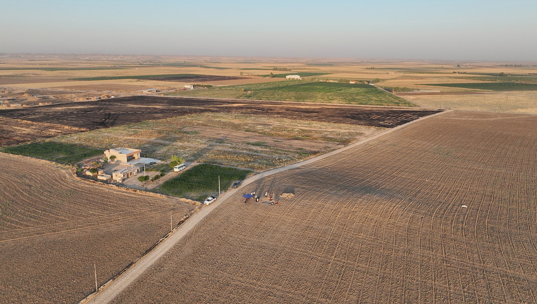
This is a view of Kharaba Tawus (Site 275) from the drone. We are looking west with the rising sun behind us casting a shadow behind the low rise that marks the high point of the ancient site. The modern road bisects the site which continues on the south (left) side of the road under the modern house. You can see our excavations starting at Kharaba Tawus. In the background towards the southwest, you can just make out a few structures which are modern brick kilns where traditional handmade bricks are produced. Much of Kharaba Tawus has been disturbed by this activity. There was a roughly 5 ha Neo-Assyrian village here although we were only able to reach a few pits filled with pottery during our short 2023 season. The site is plowed and farmed annually. The crops to the north and south of the house are maize and the harvested field to the west had onions planted there. We avoided the active fields during our surveys and excavations.
Site 290 is located at the edge of a steep escarpment at the westernmost point of our project area. When this photograph was taken, the drone was facing southeast and the excavation area, site vehicle, tent and other gear were at the northern edge of the elevated area. Although the entire site is nearly 6 ha in extent, the Neo-Assyrian component, as mapped by the EPAS team, was only 0.45 ha and limited to the western lobe of the site (i.e., from the road to the point at which the escarpment makes a sharp bend to the south). The 2023 magnetic field gradiometry maps here showed evidence of what looks like large storage facilities, smaller pits, a possible hearth, and perhaps even some mudbrick walls. A brief excavation in 2023 located in on the large storage pits brought to light a great deal of Neo-Assyrian pottery, a number of unbaked clay loom weights and a cylinder seal, suggesting a date in the Iron Age.
