Meet Site 292
In an earlier post (“The Slow March of Science” 9/21/24), I talked some about the use of magnetic field gradiometry as a way of gathering data about what is immediately below the ground without excavation. A handheld gradiometer measures minute fluctuations of the Earth’s magnetic field caused by buried artifacts, features, and changing soil types. Human activities such as building, burning things, and trash disposal alter the magnetic properties of soil in predictable ways allowing us to tell something of what happened in a place quickly. Archaeologists often use geophysical maps to determine the best place to dig.
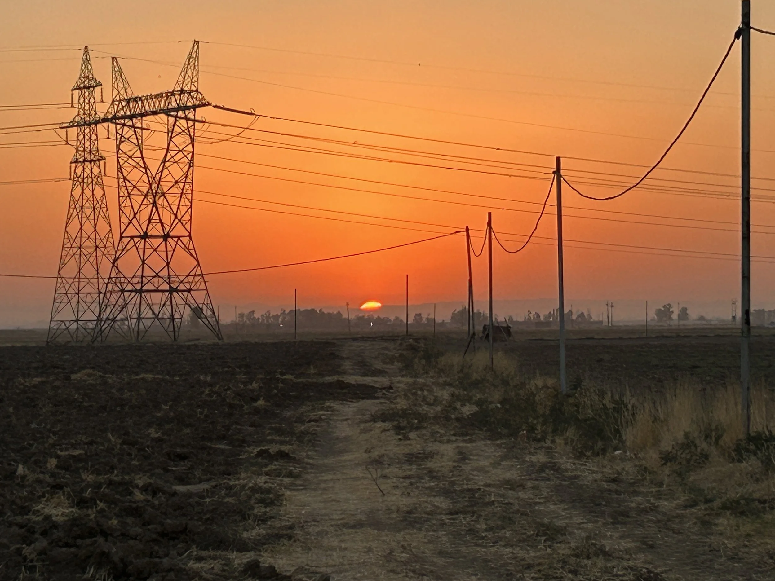
Sunrise over Site 292. This is not a pretty site, and it is impossible to avoid the tangle of power lines as the site is bisected by major electrical transmission lines.
The terms ‘flat’ and ‘nondescript’ fit Site 292 perfectly. The archaeological site covers an area of 6.74 hectares (16.7 acres) as mapped by the EPAS team. They divided the site into three parts during their surface survey in 2017, noting that Neo-Assyrian pottery only came from their Sectors 02 and 03, reducing the site of the Neo-Assyrian settlement to 5.14 hectares (12.7 acres).
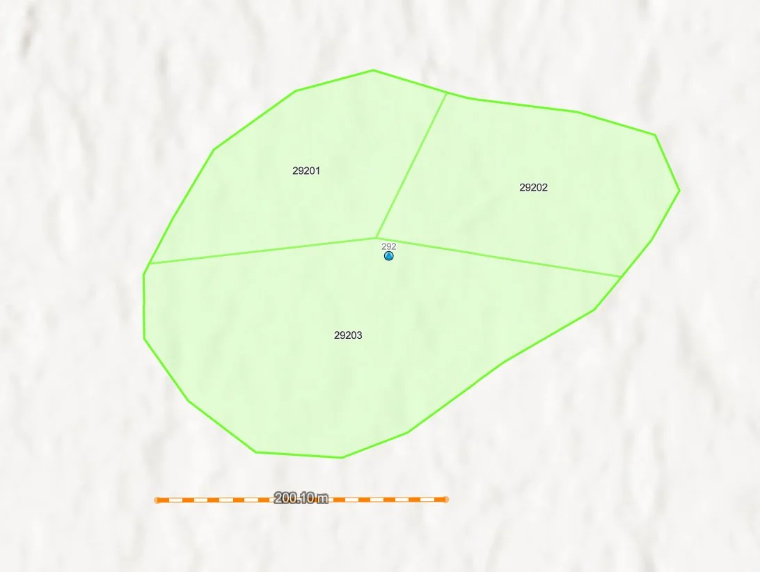
This is the map from which we are starting. The site was identified via satellite imagery by EPAS, and divided into three sectors for surface collection.
That is still a large area to survey. Excavation over such an area would take decades — we need to narrow our search for the right spot to dig. In Sector 02, the EPAS team found pottery from other time periods apart from the Neo-Assyrian (c. 900 – 600 BC): the Middle and Late Bronze Ages (covering together roughly the time period of 2000 - 1200 BC), and a later occupation dating to the Parthian/Roman period (roughly mid-3rd century BC to mid-3rd century AD). Sector 03, on the other hand, was noted as only having Neo-Assyrian remains, so we started with this part of the site to avoid complications. Our survey area is in the southwestern corner of the site.
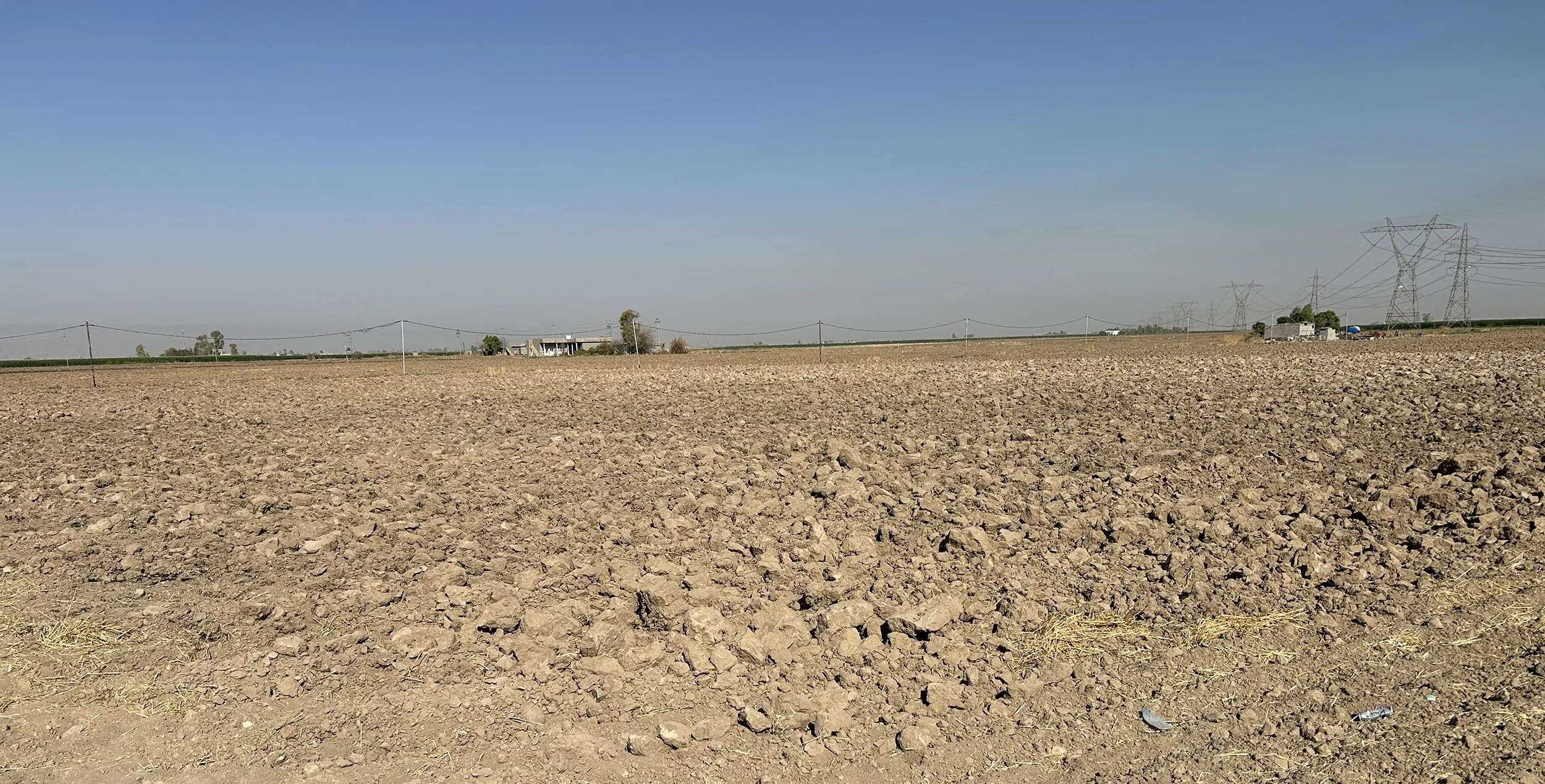
Site 292 from the road looking to the southwest.
In this photo you can see (if you look very, very closely) in the middle of the field a slight change in color to the soil (it is whiter in general) and a very slight rise in elevation. These are the kinds of subtle changes that archaeologists use to locate smaller settlements like Site 292. We are surveying on the higher ground where the soil colors indicate different soil formations. With luck, some remains from the Neo-Assyrian occupation will still be present in fields that have been intensively cultivated for centuries.