Breaking ground.
As you know, the Sebittu Project involves survey and excavation at seven sites clustered in the western Erbil plain. After I arrived in Kurdistan, one of the first items on my long to-do list was to visit each site and assess the field conditions at present. The spring was relatively wet here, so the winter crops like wheat were good and there was plenty of grazing for the herds of goats and sheep kept by the farmers. While good news, this presented us with a challenge because normally by now much of the stubble from the wheat fields would have been grazed and, thus, the ground would be clear and surface survey easy because any sherds on the ground could be easily spotted. However, this season, several of the sites still had a 15cm or so of wheat stubble, making for poor visibility.
In our conditions assessment, we did find two sites that were reasonably clear of groundcover. One was Kharaba Tawuz, which you read about earlier. The other is an unnamed site known by its EPAS survey number as #290. I will introduce you to these sites, and the others, over the course of this blog. Being small sites, they are somewhat hard to see from the ground unless you know what you are looking for. A very subtle rise in the middle of the field may well reveal an archaeological site.

Photograph of Kharaba Tawuz taken facing west in the early morning. We took advantage of the low, raking light to create shadows on the site.
Above is a drone photo taken early this morning at Kharaba Tawuz. With the long shadows, you can see the small rise that comprises the ancient site in the plowed field to the left of the track. Aerial photography has been in use in archaeology for over a century. The drone and digital camera have replaced prop-driven airplanes and film cameras and have greatly improved our mapping of the ancient landscape.

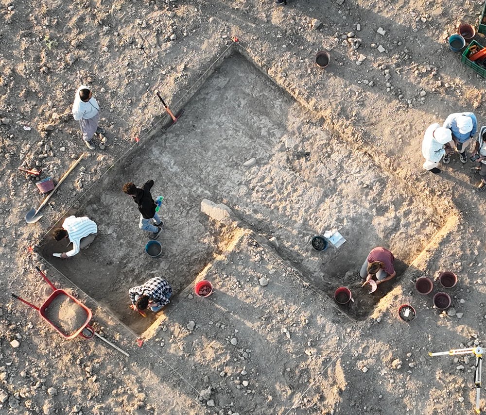
Using Britt’s surface survey, and the site topography, as a guide, we chose an area for excavation that started off as a 2.5m by 2.5m trench, but has now expanded twice so that it covers three times that area. The top 40 cm is soil that was badly churned up by the modern plowing of the field. Below that, though, we found layers that were less disturbed and contained the first intact, in situ archaeological deposits of the Sebittu project, some possibly dating to the Iron Age. More to come on what we found.