On the ground.
One question that archaeologists often get asked is ‘how do you know where to dig’? It’s a good, logical question, and one which is answered differently depending on where you are working, which cultures you and what time periods you are interested in, and what your research questions are.
We are primarily interested in documenting village and farm life in the first millennium BC, so we want to find the houses, pits, hearths, and storage rooms that people used in the Iron Age. Rather than just randomly starting to dig, we search the surface as carefully as possible for any clue about what is below ground. Sometimes this involves looking at satellite maps and aerial or drone photographs.
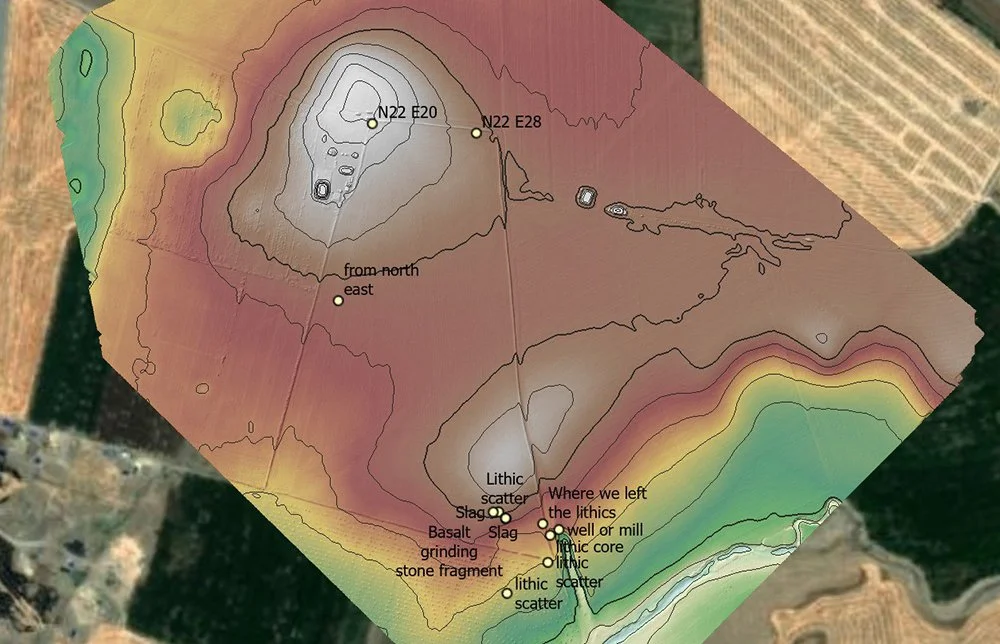
This is a drone image provided to us by Jason Ur and his EPAS team at Site 275. The contour lines show the elevations at the site with white being high elevations. This images shows our survey points (marked with coordinates) an specific find spots of items on the ground. Drone photography has revolutionized the way archaeologists record the landscape.
Surface survey involves collecting the artifacts that are just lying on top of the surface of the ground, often pulled up by the plow during preparing the fields for planting. These artifacts, although they are not in the place where ancient people left them (a condition we call in situ), they still give us an indication of what is below ground.
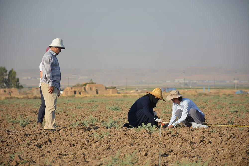
Britt and Tara set up the survey grid with tapes and wooden stakes under the careful observation of Gareeb and Mary.
Sarah took these photographs of our survey at Site 275, which a local landowner said is called Kharaba Tawus (Kurdish for “Mound of the Peacock”). After we have laid out a grid of survey squares 20m by 20m with wooden pegs marking the corners, the team lines up evenly spaced and slowly walks across the square picking up pottery. Britt then determines which sherds can be dated (these are called “diagnostics”) and all the useful sherds from each square are bagged and tagged. Later, back at the dig house, Britt compiles a distribution map showing where the greatest concentration of Iron Age pottery is found. That is where we dig!

The survey line moves across the southern field at Site 275. Mary is closest to the camera here and Rafeeq is at the far end of the 20m line. Surface survey is hot, dusty work but it is an important way to figure out what’s below ground.